Tourism : can this be the next big thing for India

Who doesn’t love to travel?

Every body seek to grab every single chance to wander around the world. Some love to travel to hills, while others are pleased to be at the sea side, other proportion of people want to travel to desert areas,and the remaining like to scratch out every corner of the world. An increase in the trend of more and more wanderlust among the people, is the reason for an increase in the trend of tourism industry. No matter where you want to travel, which part of the world you have to discover, just a click on the e-travel site and choose your favourite destination.

In case of the country, such as, India, which is counted as a developing one, it is a fresh opportunity to become the top countries to offer a great traveling experience to those coming to the country in order to observe its beauty. Post pandemic, will be a great opportunity for the government to promote tourism in the country and it will surely create a massive opportunity for the economy to bloom and grow positively. As many of the scholars have claimed that, India’s economy may fall to negative, but, tourism industry is an idom used to drown, that can help the country with incredible increase in the number of tourists.

About 10.89 million foreign tourists visited India in 2019. But, according to the UN World Tourism Organization, 50 million Indians will travel overseas in 2019, which is a big reason to worry regarding the tourism industry in the country. There is a huge gap between people coming and going out of the country which needs to be filled, in order to see India as a huge tourist destination.

It is one of the reasons why tourism can be next big thing for India! We have been privileged to be a part of such a beautiful country as this, where every kind of physiographic divisions could be found, be it Jammu and Kashmir, pure heaven on the earth; or the widespread desert of Rajasthan; backwaters of Kerala;beaches of Mumbai and Goa;historic sites of Central India; beauty of northeast India; and all that enormous beauty that is untouched by most of the travellers.

But, the pandemic has given a jerk to the tourism industry, which has been a great source of income to the country, due to shut down offices of travel companies, tourist destinations, along with, hotel, restaurant chains, along with the suspension of, both, national, as well as international flights, ultimately bearing the loss hit by the pandemic.

The Indian tourism industry is projected to book a revenue loss of Rs. 1.25 trillion, in calendar 2020,which means a 40% decline in revenue over calendar 2019.

But, as it has been righteously said that, the population of any country is its wealth, we as the wealth of our country must only visit the tourist attractions in our own country (post pandemic) in order to give a hike to its economy. This would complete the twin objective

  • One is, to give a boost to the economic conditions of the country.
  • Second is, it will give us a chance to explore the unseen beauty of our own country and people will not underestimate the power of the country.

DARJEELING

Location

Darjeeling is a city and a municipality in the Indian state of West Bengal. It is located in the Lesser Himalayas at an elevation of 2,000 metres (6,700 ft). It is noted for its tea industry, its views of Kanchenjunga, the world’s third-highest mountain, and the Darjeeling Himalayan Railway, a UNESCO World Heritage Site. Darjeeling is the headquarters of the Darjeeling district which has a partially autonomous status called Gorkhaland Territorial Administration within the state of West Bengal. It is also a popular tourist destination in India.

History

The recorded history of the town starts from the early 19th century when the colonial administration under the British Raj set up a sanatorium and a military depot in the region. Subsequently, extensive tea plantations were established in the region and tea growers developed hybrids of black tea and created new fermentation techniques. The resultant distinctive Darjeeling tea is internationally recognised and ranks among the most popular black teas in the world.The Darjeeling Himalayan Railway connects the town with the plains and has some of the few steam locomotives still in service in India.

Darjeeling has several British-style private schools, which attract pupils from all over India and a few neighbouring countries. The varied culture of the town reflects its diverse demographic milieu comprising Lepcha, Khampa, Gorkha, Newar, Sherpa, Bhutia, Bengali and other mainland Indian ethno-linguistic groups. Darjeeling, alongside its neighbouring town of Kalimpong, was the centre of the Gorkhaland social movement in the 1980s and summer 2017.

How to go

By air: The nearest airport to Darjeeling is Bagdogra which is approximately 95 km away from the city. There are some direct flights from the cities like Kolkata, Delhi and Guwahati to Darjeeling. From the airport, one can reach the city by hiring taxis. It will take almost 3 hours to reach Darjeeling from the airport. Flights are available from all major cities.

By rail: The nearest railway station to Darjeeling is New Jalpaiguri which connects the city with all the major parts of the country. There are a number of trains from cities like Kolkata, Delhi, Guwahati, Chennai, Mumbai, Bengaluru, Bhubaneshwar and Kochi. People can hire private cabs from the station to reach Darjeeling.

By road: Darjeeling is well connected to some of the major cities closeby such as Gangtok and Kalimpong which are located at a distance of 100 km and 51 km respectively. The city is also connected with Kolkata which is 651 km away and it takes around 14 hours to reach here. The capital city of Nepal, Kathmandu is just 310 KM away from this beautiful place.

Places to visit

Darjeeling Himalayan Railway:  A visit to the city of Darjeeling is incomplete without a joyride at the Darjeeling Himalayan Railway toy train. Moving at a snail pace over the hilly terrain, it is an experience no one wants to miss.

Tiger Hill: If you want to witness the first rays of sun hitting the twin peaks of Kangchenjunga, along with a panoramic view of Everest peeping through the peaks standing by its side, then Tiger Hills make for a perfect sunrise for you. You can see Kurseong to the south along with multiple rivers flowing down. Senchal Wildlife Sanctuary is another nearby attraction you could visit – the place inhabits various high-altitude animals and bird.

Batasia Loop: Located around 5 km from Darjeeling, Batasia loop is a spiral railway track where the toy train takes a complete 360 degree turn. The toy train descends by 1,000 ft. as it completes the loop through a large circular area.

Darjeeling Ropeway: Darjeeling Ropeway is a cable car circuit where one can witness a myriad of exquisite landscapes, from the glorious snow-capped mountains to the charming valley replete with verdant tea estates.

Himalayan Mountaineering Institute: The Himalayan Mountaineering Institute, commonly known as HMI Darjeeling, was established on November 4, 1954 primarily to encourage mountaineering as an organized sport in India. HMI regularly conducts Adventure, Basic and Advanced levels of mountaineering courses which are very comprehensive courses. These courses are highly subsidised to encourage mountaineering as a sport.

Nightingle Park: This park was earlier called ‘The Shrubbery’ when it was a private courtyard. The park was closed for renovation for about four years and has reopened for public since 2011. There is a giant statue of Lord Shiva, a musical fountain along with the great scenery.

Darjeeling Rock Garden: The Rock Garden or the Barbotey Garden as it’s commonly known is located a little far from the city around ~10 km away. The benches in the garden are made by cutting rocks at different levels.

River rafting in Teesta:  White Water Rafting in the River Teesta is one of the most exciting things to do in Darjeeling. A favourite among the adventure junkies, the rafting has a series of rapids ranging from Grade 1 to 4. However, the difficult rapids are only allowed to the professionals or the seasonal trainers as it is risky. You should definitely try this activity when in Darjeeling.

Why should you visit Darjeeling?

View of Himalayas: Darjeeling offers some breath taking panoramas from almost any guesthouse or hotel in town that has a roof terrace. Try Magnolia Residency for a hearty breakfast and amazing sunrise views, or follow the pilgrims out to Tiger Hill for stunning vistas of the snow-capped mountain Kanchenjunga. Like a guard that towers over the town and standing at 8,598 metres, it is India’s highest peak and the third highest in the word. If you are lucky on a clear day you might even catch a glimpse of Mount Everest glinting in the distance as Tibetan prayer flags flutter around you in the breeze.

Tea: A visit to Darjeeling would not be complete without sampling a steaming hot cup of the internationally acclaimed Darjeeling tea. With a distinct flavour like no other tea it is best served black, with no milk or sugar to distract from the delicate flavours said to have notes of apricot and toasted nuts; And when you have had enough of drinking the tea, head down to Happy Valley Tea Estate, (an organic farm and member of the ethical tea board) for a guided tour of their tea factory. By the time you leave you will know the difference between whole leaf, first blush and oxidisation like a seasoned pro. Once the tour is finished, be sure to take a long walk through the tea terraces for spectacular views and a glimpse of the tea pickers in action. The Happy Valley Factory tour is free, running from 8am-4pm every day except Sunday. If you can, try to arrive before 11.30am to see the pickers at work in the fields.

Colourful houses: Nothing sums up Darjeeling’s character and atmosphere quite like its collection of pastel-hued houses stacked up almost on top of each other – clinging to the hillside in a type of ramble shackle beauty. Walks around town and further afield will throw up houses in all shades of the rainbow – the perfect setting for the vibrant culture of the people who live here.

Taste of Britain: If you are feeling nostalgic for good ol’ British cucumber sandwiches and cream scones then Darjeeling will satisfy all your cravings. Formally a military hill station set up by the British armed forces in the mid 19th century, they left their imprint on the place in the form of Afternoon Tea. Darjeeling is still home to a few colonial style hotels that serve up traditional British fare like cheese and pickle sandwiches, Victoria sponge and of course lashing of locally grown Darjeeling tea. Try the Windamere Hotel for a step back in time and have high tea served to you while warming your bones in front of their open coal fire.

The food: Being a border town with so many fascinating neighbouring cuisines it is no wonder Darjeeling has so much to offer for your taste buds. For truly Indian flavours you can sample crispy Dosas served with hot samba and coconut chutney at the tourist hot spot Hasty Tasty. This place also has spectacular views over the mountains. For more international tastes warm up with a hearty bowl of Tibetan Thukpa (soup made with noodles, meat and broth) and deliciously plump Momos (dumplings filled with meat or vegetables) and wash it all down with a cup of sweet and salty Yak Butter Tea. Visit the family run restaurant Kunga – a favourite among the locals and known for truly authentic Tibetan flavours.

MANALI

Location

Manali is a resort town nestled in the mountains of the Indian state of Himachal Pradesh near the northern end of the Kullu Valley in the Beas River Valley. It is located in the Kullu district, about 270 km north of the state capital, Shimla, 309 km north east of Chandigarh and 544 km northeast of Delhi, the national capital. The small town, with a population of 8,096, is the beginning of an ancient trade route to Ladakh and from there over the Karakoram Pass on to Yarkand and Khotan in the Tarim Basin. It is a popular tourist destination and serves as the gateway to Lahaul and Spiti district as well as Leh.

Photo by Lisa Fotios on Pexels.com

History

Manali is named after the Sanatan Hindu lawgiver Manu. The name Manali is regarded as the derivative of ‘Manu-Alaya’ which literally means ‘the abode of Manu’. Legend has it that sage Manu stepped off his ark in Manali to recreate human life after a great flood had deluged the world. Manali lies in the North of Kullu Valley. The valley is often referred to as the ‘Valley of the Gods’. Old Manali village has an ancient temple dedicated to sage Manu.

The British introduced apple trees in the area. The first apple orchard was set up by the British near Patlikuhal, before this, no Apple trees grew in the area. To this day, apple— along with plum and pear— remain the best source of income for the majority of inhabitants. Both Rainbow and Brown Trout was also introduced into the rivers and streams of the area by the colonisers.

With the increase in disposable incomes and somewhat owing to the rise of disturbances in Kashmir in the late 1980s, Manali witnessed a surge in tourist traffic. This once quiet village was transformed into a bustling town with numerous homestays as well as the occasional boutique hotel. During the warmer summer months, cafes and restaurants can be seen doing brisk business.

How to go

By air: The nearest airport is at Bhuntar, located approximately 50 kilometres away from Manali. Domestic flights connect Bhuntar with Delhi and Chandigarh. Once at the airport, you can take a pre-paid taxi to Manali. However, owing to weather conditions, flights are not the most reliable option for getting to or out of Manali.

By bus: Manali is very well-connected to important tourist destinations like Leh, Shimla, Kullu, Dharamshala and New Delhi by means of a network of state-run as well as private buses. The bus journey from Delhi to Manali is 550 kilometres, and it is advisable to book your tickets in the air-conditioned Volvo coaches, as the buses are more comfortable than ordinary ones, keeping in mind the long distance of the journey.

By road/self-drive: The drive up to Manali is simply breathtaking! You can catch scenic glimpses of the adjoining mountains and valleys from almost every turn that the twisty uphill road throws you in. Though a lot of tourists prefer a self-drive up to Manali, it is advisable to hire a taxi in case you are not comfortable with driving in mountainous regions.

Popular Places:

Solang Valley: A valley between the Beas Kund and the Solang village tends to be a favorite for all its visitors as well as the locals. Also known as the Snow point, the Solang valley is famous not only for the glaciers and snow-clad landscapes but also for the countless activities that one can enjoy here.

Rohtang Pass: Rohtang pass is the stretch which connects Manali to Himachal’s dreamier and dessert like landscapes, Spiti and Lahaul, and is one itself. This vast snow desert is a landscape like only a few other and a view one should not miss, while here.

Beas Kund Trek: The Beas Kund trek is a perfect weekend getaway trek with outstanding views of Pir Pinjal mountain ranges over the Beas River. Let your soul get wooed by the spectacular meadows of Dhundi and Bakarthach and finally, the glacial lake at Beas Kund which is worth all the hiking.

Paragliding: The hillside town of Manali is famous for paragliding. At 2050 metres above sea level, it is an ultimate location for the sport, with its beautiful green valleys, stark blue skies, and snow-capped mountain peaks. The picture-perfect valley boasts of ideal wind conditions for paragliding and is thronged by both international and domestic tourists. Starting with a basic training course, the operators are well organized, competent and trustworthy.

Hadimba Temple: Hadimba temple, away from the hustle and bustle of city life, is a peaceful place surrounded by towering deodar trees. The temple is dedicated to Hidimba, the wife of Bhima, one of the five Pandava princes from the great Indian epic Mahabharata. The main attraction of the temple is the three day Hidimba Devi Festival, which attracts devotees from all over the world and features colourful folk dance performances.

Skiing: A major tourist spot of North India, Manali is known for its excellent skiing conditions with skiing enthusiasts visiting from all over the country. The undulating slopes of Solang Valley and Rohtang Pass offer a perfect terrain for amateurs to learn their first move while an ideal grounds for professional skiing in Manali. So, if you are an adventure lover, leave yourself in the hands of your professional trainers to feel the thrill of skiing in the picturesque setting of Manali.

Chandratal Baralacha Lake: Chandratal Baralacha is a perfect trek destination steeped with all the right elements – nature’s beauty and enough challenges to be thrilling and tranquillity. Perched at an altitude of 4,300 meters, Chandratal is one of the high altitude lakes in the Himalayan region. Located on the Samudra Plateau of Spiti Valley, the most delightful sight of sunset gleaming upon the turquoise waters of the lake, pristine landscape, mountain passes, several gushing streams, verdant meadows, the gush of colourful orchards and exotic wildlife make Chandratal Baralacha Trek an unforgotten experience to cherish forever.

Why visit Manali?

Trekking Trails: Trekking is one of the most popular activities that many people love to do because it makes them feel more adventurous and close to Mother Nature. Manali is considered a paradise for trekking enthusiasts as it is the starting point of many amazing trekking trails. The most famous trek is the Hampta Pass, which starts from Jobri Nala. Some of the other treks are Beas Kund, Bhrigu Lake, Dashaur Lake, Patalsu Peak, Lamadugh, Hampta Circuit, Deo Tibba base camp, etc.

Vibrant Markets: Markets and mall roads are considered the lifeline of hill stations. Manali is home to a vast Tibetan market where one can find and shop varieties of clothes and souvenirs. The old Manali area is home to several cool cafes where one can chill out and spend a pleasant evening.

Waterfalls: Waterfalls are the only place where one can sit for hours and enjoy the sound of gushing water. Manali houses a famous waterfall called Jogini waterfall situated around 7.5 km from the main city. The place is perfect for spending quality time.

Mountain Biking: The most exciting thing about the mountains is the road and mountain biking can give you once in a lifetime experience. The curvaceous and adventurous roads can amaze anyone with its thrill. So if you are an adventure buff then it’s a must try activity in Manali. Bikes can easily be rented in Manali.

Hot Sulphur Baths: The natural hot water springs are one of the most exciting phenomena and found in the mountains. Taking a bath in these springs can give you an amazing relief. Manali houses one hot water spring situated at Vashisht Temple.

So this summer head out to Manali to beat the city heat and have a memorable trip. What are you waiting for?

MURSHIDABAD

Location

Murshidabad is a town in the Indian state of West Bengal. It is located on the eastern bank of the Hooghly River, a distributary of the Ganges River. It forms part of the Murshidabad district.

The District of Murshidabad has an area of 5,550 square kilometres. It is divided into two nearly equal portions by the Bhagirathi, the ancient channel of the Ganges. The tract to the west, known as the Rarh, consists of hard clay and nodular limestone. The general level is high, but interspersed with marshes and seamed by hill torrents. The Bagri or eastern half belongs to alluvial plains of eastern Bengal. There are few permanent swamps; but the whole country is low-lying, and liable to annual inundation. In the north-west are a few small detached hillocks, said to be of basaltic formation.

History

During the 18th-century, Murshidabad was a prosperous city. It was the capital of the Bengal Subah in the Mughal Empire for seventy years, with a jurisdiction covering modern-day Bangladesh and the Indian states of West Bengal, Bihar and Orissa. It was the seat of the hereditary Nawab of Bengal and the state’s treasury, revenue office and judiciary. Bengal was the richest Mughal province. Murshidabad was a cosmopolitan city. Its population peaked at 700,000 in the 1750s. It was home to wealthy banking and merchant families from different parts of the Indian subcontinent and wider Eurasia, including the Jagat Seth and Armenians.

European companies, including the British East India Company, the French East India Company, the Dutch East India Company and the Danish East India Company, conducted business and operated factories around the city. Silk was a major product of Murshidabad. The city was also a center of art and culture, including for ivory sculptors, Hindustani classical music and the Murshidabad style of Mughal painting.

The city’s decline began with the defeat of the last independent Nawab of Bengal Siraj-ud-Daulah at the Battle of Plassey in 1757. The Nawab was demoted to the status of a zamindar known as the Nawab of Murshidabad. The British shifted the treasury, courts and revenue office to Calcutta. In the 19th century, the population was estimated to be 46,000. Murshidabad became a district headquarters of the Bengal Presidency. It was declared as a municipality in 1869.

How to go?

Murshidabad is well connected to the rest of India by rail & road. Regular rail, as well as bus services, ply to and fro Murshidabad junction, well connected by several passenger and express trains. There are no direct buses for Murshidabad; you need to break your journey at Malda for a taxi to the same. There is no direct flight connectivity for Murshidabad. The nearest airport is the Netaji Subhas Chandra Bose International Airport in Kolkata.

Main attraction – Hazarduari Palace

As the name suggests, Hazarduari is a palace with thousand doors. The palace was built in the nineteenth century during the reign of Nawab Nizam Humayun Jah who ruled Bengal, Bihar and Odisha. The architect of this masterpiece was Duncan Macleod.

What makes the palace unique?

It is not just the number of the doors that make the palace different from the rest, it is interesting to know that out of these thousand doors, only 100 of them were real doors, and the rest 900 were fake ones. You may wonder what the mystery behind the fake doors is. Well, the doors were built this way to protect the palace from predators. The idea was to confuse the attackers who attack the palace and try to escape, giving the Nawab’s guards enough time to catch them.

Palace Complex

The palace enclosure is known as Nizamat Kila or Kila Nizamat. Apart from this stunning structure, the palace complex also has Nizamat Imambara (a Muslim congregation hall), Wasif Manzil, Bacchawali Tope, Nawab Bahadur’s institution and three mosques that include the Madina mosque. Built just 40ft away from the banks of Bhagirathi River, the foundation of the palace was laid very deep, so the structure stays strong. The grand staircase to the palace and the Indo-European architectural style are other highlights of this magnificent structure. The palace was used as a venue for royal meetings and official discussions between the British and the Nawabs, and also as a residence for high-ranking British officials. However, today the palace is a museum that preserves the precious collection of the Nawabs that include furniture, paintings and antique pieces.

Palace Museum

The palace museum is today the biggest site museum managed by the Archaeological Survey of India (ASI). The antiquities of the palace museum include the belongings of the royal family, which include a stunning chandelier of the Durbar hall which is the world’s second largest chandelier in the world, the first being one in the Buckingham Palace. This chandelier was gifted to the Nawab by Queen Victoria. The museum galleries include Armoury wings, Royal Exhibits, Landscape Gallery, British Portrait Gallery, Nawab Nazim Gallery, Durbar Hall, Committee Room, Billboards Room, Western Drawing room and Religious Objects’ Gallery to name a few. The palace is located at Murshidabad at West Bengal, and here’s how you can reach Murshidabad.

Overall, it’s a really nice place to have a refreshing weekend. You can enjoy the rich heritage of Indian history and have a quick glance into the Mughal era. So what are you waiting for? Pack up your bags and set out to seek the unknown!

SHILLONG

Location

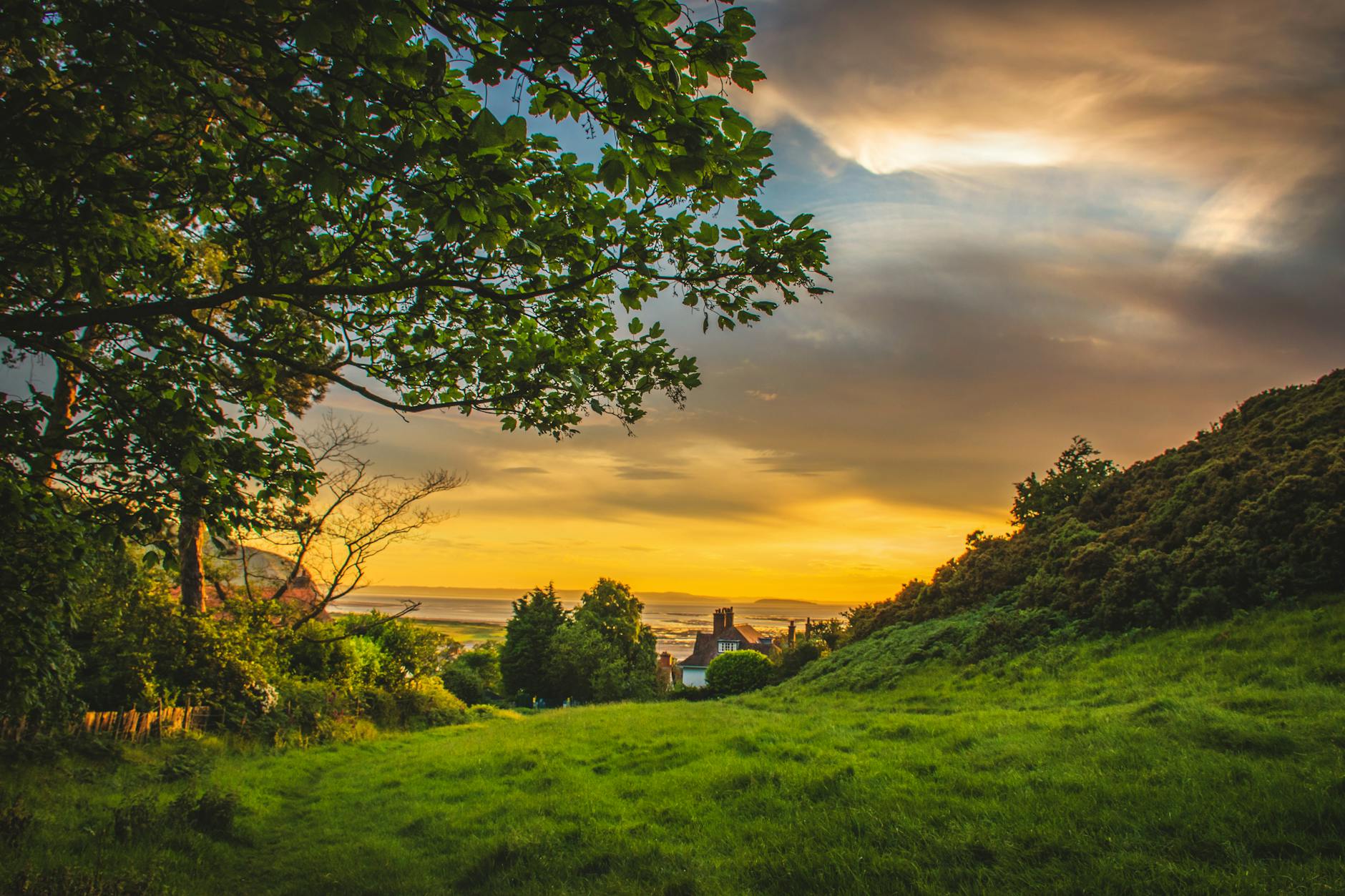
Shillong is a hill station in the northeastern part of India and the capital of Meghalaya, which means “The Abode of Clouds”. Shillong lies on the Shillong Plateau, the only major uplifted structure in the northern Indian shield. The city lies in the centre of the plateau and is surrounded by hills, three of which are revered in Khasi tradition: Lum Sohpetbneng, Lum Diengiei, and Lum Shillong.

It is the headquarters of the East Khasi Hills district. Shillong is the 330th most populous city in India with a population of 143,229 according to the 2011 census. It is said that the rolling hills around the town reminded the British of Scotland. Hence, they would also refer to it as the “Scotland of the East”.

Shillong, the capital city of Meghalaya is just 100 km from Guwahati, which can be accessed by road along NH 40, a journey of about 2 hours 30 minutes through lush green hills and the magnificent Umiam Lake in between.

History

The Shillong Municipal Board has a long history dating back to 1878, when a proclamation was issued constituting Shillong and its suburbs, including the villages of Mawkhar and Laban, into a station under the Bengal Municipal Act of 1876. Inclusion of the villages of Mawkhar and Laban (Lumparing, Madan laban, Kench’s Trace and Rilbong) within the Municipality of Shillong was agreed to by Hain Manik Syiem of Mylliem under the agreement of 15 November 1878. But, there is no trace of Shillong in the British era maps dating back to 1878, up to 1900.

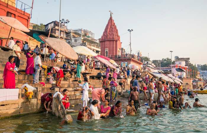
Shillong was also the subject of the great earthquake that occurred on 12 June 1897. The earthquake had an estimated moment magnitude of 8.1. Twenty-seven lives from Shillong town alone were lost and a major part of the town was destroyed.

How to go

By air: Shillong Airport in Umroi is a small airport that is available for the flights and is located at a distance of 40 km from Shillong. Bus services are provided by Meghalaya Transport Corporation from the airport to the various cities of the state. There are regular flights from Shillong to Ahmedabad, Aizawl, Bangalore, Chennai, Delhi and various other destinations.

 By rail: There are as such no proper rail lines in Meghalaya. Guwahati railway station is the nearest railway station situated at a distance of 105 Km from Shillong. The city is well connected to all other major cities of the country via rail medium. There are also taxi as well as bus facility for Shillong.

By road: Assam State Transport Corporation and Meghalaya Transport Corporation run buses from Guwahati to Shillong. The main interstate bus stand is located near to Guwahati railway station. Reasonable prices for different types of buses like AC, AC Sleeper, luxury and Volvo buses are available for Shillong. Some of the places nearby which you can visit are Cherrapunji and Jowai.

Places to visit

Umiam Lake: Umiam Lake, a mesmerizing man-made reservoir, is located at a distance of 15 kilometres north of Shillong which is the capital of the north-eastern Indian state of Meghalaya. The lake was formed after a dam was constructed to generate hydroelectric power. The scenic Umiam Lake is encircled by lush green East Khasi hills that form one of the best panoramic sights for nature-lovers in the country. The sunrise at the lake is a treat to watch and shouldn’t be missed. The Umiam Lake has a park adjoining it which is a hotspot for picnics and frequented by locals for a getaway from their busy scheduled.

 Elephant Falls: Named after an Elephant like stone at its foot, the Elephant Falls are amongst the most popular falls in the North-East, situated next to Shillong. It is a tourists’ paradise with three layers of the falls accessible to the layman from different vantage points. The Britishers named this fall so owing to the presence of an elephant-shaped rock on one side of the fall. However, the stone disintegrated and was washed away due to an earthquake in 1897. Elephant Waterfalls is a superb place for spending some time in the midst of nature while capturing the incredible moments for your keepsake.

Police Bazaar: Police Bazaar is the major market of Shillong, and a popular shopping haunt for locals and tourists alike. In addition to an array of restaurants, hotels and big brand stores, the Police Bazaar also has a flea market section which is pocket-friendly and draws the maximum number of tourists owing to its traditional handicrafts stores, exquisite Meghalaya merchandise, regional apparels, junk jewellery and the like. The colourful market is thronged by shopping enthusiasts as well as foodies.

Laitlum Canyons: Perched on the East Khasi Hills, Laitlum Canyons is a less explored but one of the most picturesque tourist and trekking destinations in Shillong. The canyons are located about 21 kilometers south of Shillong which is about a half-hour drive away. Literally, translating to ‘End of hills’, this exotic viewing site offers the best panoramic views of the whole of Meghalaya embraced by the majestic hills and valleys. The spot is secluded and serene, ideal for quiet and peaceful getaways. It can be visited by families, friend groups as well as couples. To catch this place at its best, visit Laitlum Canyons either during sunrise or sunset.

Shillong Peak: At the height of 6449 ft or 1965 m above sea level, Shillong Peak is the highest point of Shillong. It offers a breathtaking panoramic view of the entire city, the Himalayas, its waterfalls as well as of the Bangladesh plains. A telescope is available for tourists to get a bird’s eye view. Trekking up to this semi-circular Shillong Peak is highly recommended for the best views but it is often bounded by heavy fog.

Mawphlang: Mawphlang, home to Meghalaya’s Sacred Forest, is a beautiful village situated 25 kilometres away from Shillong, the capital city of the north-east Indian state of Meghalaya. The village lies in the district of East Khasi Hills and is famous for its sacred groves. The village is named Mawphlang as it is one of the several monoliths in the Khasi Hills. The name Mawphlang means Grassy Stone and is a land of legendary stories, sacrifices and unique culture. For the ones who want a glimpse of the tradition, culture and lifestyle of the Khasis that is fading away in the modern world, Mawphlang is the place to visit.

Ward’s Lake: A pretty artificial lake surrounded by gardens is an ideal evening get away! Also known as the Polok Lake, it is usually flocked by couples, picnickers and locals.

Don Bosco Museum: Hailed as Asia’s largest Museum of Indigenous Cultures, the Don Bosco Museum is the house of the beautiful culture and tradition of North East India. It is conveniently located in the Mawlai area, near the Police Bazaar. With its seven storeys, it rises into the skyline of Shillong and flaunts 16 laid out galleries that showcase artifacts, paintings, figures significant to the Northeastern culture. Not only do these provide a feast to the eyes of the visitors, but also give an insight into the lifestyle of the North-Eastern people.

David Scott Trail: Most popular trekking routes of Meghalaya, this path was originally laid by David Scott, a British officer as early as in the 1800s. It is still used to commute between Assam and Bangladesh.

Mawlynnong: Mawlynnong is a small village situated around 90 km from Shillong in the East Khasi Hills, Meghalaya and is also known as God’s own Garden. It was declared as the cleanest village in Asia in 2003 by Discovery India which certainly which makes it one of the most popular tourist destinations in the Indian state. Mawlynnong village is a community-based ecotourism initiative where the entire community made collective efforts in making and maintaining the cleanliness of the village.

Why visit Shillong?

Rarest and friendly tribes: The Shillong population mostly belongs to the Khasi tribe, who are predominantly Christian. There are also a significant number of Assamese, Bengali and Nepali minorities. An interesting aspect of the Khasis is that they are a matrilineal society. Therefore the mother’s surname is passed on to the children and the youngest daughter inherits the ancestral property.

Can you imagine the celebration the birth of a daughter entails? And the special pampering the youngest daughter receives?

Thrilling peak: Located at a height of 1,496 meters above sea level, Shillong is a great destination and a treat for nature lovers. Situated 10 kilometers from the city, the Shillong Peak offers spectacular views of the city from a lofty height of 1,965 meters above sea level. Being the highest point in Shillong, it gives impressive views of lush greenery and cascading waterfalls. On a cloudless day you will be able to view the majestic Himalayan peaks and the forever inundated Bangladesh plains in the distance. The Indian Air Force has its radar station here.

Cherapunjee: Meghalaya or the Abode of the Clouds is famous for Cherrapunji and Mawsynram, which are the wettest places on earth. This makes it a popular monsoon destination. Cherrapunji, which lies 15 kilometer to the east of Shillong, offers guest houses, resorts, cottages and home-stays for visitors. Eating in Cherrapunji is a great experience. You can enjoy the succulent Khasi cuisine like pork rice. Sohra Pulao, which is rice cooked with oil and vegetables without spices, should not be missed.

Living Root Bridges: Deep in the dense tropical forests of Meghalaya, and shrouded in cloud and rain for much of the year, are some astonishing natural wonders. Known as living root bridges, and preserved as UNESCO heritage site, these roots of ancient rubber trees or Ficus Elastica have been trained by the Khasi tribesmen, to grow in a tangled mess, which have then been intertwined and intermingled to form double and single decker root bridges that are intriguing the world. Strong as they are, the bridges take 10 to 15 years to become functional enough to hold the weight of more than 50 people at a time. The wonderful bridges are alive and still growing and thus get stronger over time.

Mawsmai Caves: Meghalaya has the longest cave system of India situated in the Jaintia Hills. Of them all, Mawsmai are easily the most favourite caves for many travellers, as it is one of the few caves one can explore without a guide. Just about 6 kilometers from the main town of Cherrapunji and an enchanting drive through golden autumnal grasslands, one finally reaches a thick grove. Mawsmai, the limestone caves, lie hidden beneath these trees! The cave has a wide opening but it soon gets narrower and is best avoided if one is claustrophobic, has health issues or weight problems.

The cave is a one way road, so the adventurous visitor enters from one end and goes out of the other. In the middle, there are places where you’ve to bend and squeeze yourself out. The channel gets narrower and the walking pace is slow, but there is no turning back! The cave is well lit with electricity and you can see each and every detail of the rock formation.

The colours and shapes come alive and you can interpret different figures for the fun of it. Rocks glint in the light as water drips down from the stone tips. It’s a marvel how these tiny drops change the appearance of hard rocks, working on them tirelessly for decades like a patient artist. With bats and insects flying around, tiny passages where one shrinks and crawls, shadows and shapes filling the air and the thrill of being inside a cave, the mere 150 meters of the cave length appears unending and hugely exciting.

So what are you waiting for? Pack up your bags and set out to seek the unknown!

AGRA

Location

Agra is a city on the banks of the Yamuna river in the Indian state of Uttar Pradesh. It is 206 kilometres (128 mi) south of the national capital New Delhi. Agra is the fourth-most populous city in Uttar Pradesh and 24th in India.

Historical Significance

There was an early reference to an “Agravana” in the ancient Sanskrit epic Mahabharata, and Ptolemy is said to have called the site “Agra.” The city was founded by Sultan Sikandar of the Lodhi dynasty in the early 16th century to be the capital of the Delhi sultanate. Agra also served as the Mughal capital during some periods of that empire. In the late 18th century the city fell successively to the Jats, the Marathas, the Mughals, the ruler of Gwalior, and, finally, the British in 1803. It was the capital of Agra (later North-Western) province from 1833 to 1868 and was one of the main centres of the Indian Mutiny (1857–58).

Places to visit         

  1. Taj Mahal – Agra is best known for the Taj Mahal (17th century) which was designated a UNESCO World Heritage site in 1983. A complex mausoleum, the Taj Mahal is often considered to be the world’s best example of Mughal architecture. The Mughal emperor Shah Jahan built it for his favourite wife, Mumtaz Maḥal, in the mid-17th century. Agra Fort (16th century), called the Red Fort for its massive red sandstone walls, was built by the emperor Akbar; it contains the Pearl Mosque (Moti Masjid; 17th century), constructed of white marble, and a palace, the Jahangiri Mahal. The fort was also designated a World Heritage site in 1983.
  2. Agra Fort – A stone tablet at the gate of the Fort states that it had been built before 1000 but was later renovated by Akbar. The red sandstone fort was converted into a palace during Shah Jahan’s time, and reworked extensively with marble and pietra dura inlay. Notable buildings in the fort include the Pearl Mosque or Moti Masjid, the Diwan-e-Aam and Diwan-e-Khaas (halls of public and private audience), Jahangir’s Palace, Khaas Mahal, Shish Mahal (mirrored palace), and the Musamman Burj. The forbidding exteriors of this fort conceal an inner paradise. The fort is crescent-shaped, flattened on the east with a long, nearly straight wall facing the river. It has a total perimeter of 2.4 kilometres (1.5 mi), and is ringed by double castellated ramparts of red sandstone punctuated at regular intervals by bastions. A moat 9 metres (30 ft) wide and 10 metres (33 ft) deep surrounds the outer wall.
  3. Fatehpur Sikri – The Mughal Emperor Akbar built Fatehpur Sikri about 35 km (22 mi) from Agra, and moved his capital there. Later abandoned, the site displays a number of buildings of significant historical importance. A World Heritage Site, it is often visited by tourists. The name of the place came about after the Mughal Emperor Babur defeated Raṇa Sanga in a battle at a place called Sikra (about 40 km from Agra). Then the Mughal Emperor Akbar wanted to make Fatehpur Sikri his headquarters, so he built a majestic fort; due to the shortage of water, however, he had to ultimately move his headquarters to Agra Fort.
  4. Buland Darwaza – or ‘the lofty gateway’ was built by the great Mughal emperor, Akbar in 1601 CE at Fatehpur Sikri. Akbar built the Buland Darwaza to commemorate his victory over Gujarat. The Buland Darwaza is approached by 52 steps. The Buland Darwaza is 53.63 metres (175.95 feet) high and 35 metres (115 feet) wide. It is made of red and buff sandstone, decorated by carving and black and white marble inlays. An inscription on the central face of the Buland Darwaza demonstrates Akbar’s religious broad-mindedness; it is a message from Jesus advising his followers not to consider this world as their permanent home.
  5. Tomb of Itimad-ud-Daulah – It is a Mughal mausoleum in the city of Agra in the Indian state of Uttar Pradesh. Often described as a “jewel box”, sometimes called the “Bachcha Taj”, the tomb of Itimad-ud-Daulah is often regarded as a draft of the Taj Mahal. Along with the main building, the structure consists of numerous outbuildings and gardens. The tomb, built between 1622 and 1628, represents a transition between the first phase of monumental Mughal architecture – primarily built from red sandstone with marble decorations, as in Humayun’s Tomb in Delhi and Akbar’s tomb in Sikandra – to its second phase, based on white marble and pietra dura inlay, most elegantly realized in the Taj Mahal. The mausoleum was commissioned by Nur Jahan, the wife of Jahangir, for her father Mirza Ghiyas Beg, originally a Persian Amir in exile, who had been given the title of Itimad-ud-Daulah (pillar of the state). Mirza Ghiyas Beg was also the grandfather of Mumtaz Mahal (originally named Arjumand Bano, daughter of Asaf Khan), the wife of the emperor Shah Jahan, responsible for the construction of the Taj Mahal. Nur Jahan was also responsible for the construction of the Tomb of Jahangir in Lahore. It is noticeable for the first use of pietra dura (floral design made up of semiprecious stone) technique.

6. Akbar’s Tomb – The Tomb of the mighty Mughal Emperor Akbar is situated in the outskirts of Agra. The emperor got his tomb monument constructed while he was alive as his final resting place. His son Jahangir finished the complete construction which is totally done with sandstone and white marble. The monument that is found in Sikandra within the suburbs of Agra is built over a region of 119 acres surrounded by lovely gardens designed by the Emperor Akbar. Overseeing the tomb of himself while living is part of the Tartary tradition which Akbar followed for his own tomb. The tomb is toward the rising sun and roughly a kilometer close to his wife’s tomb also in Sikandra.

Other details

Tourism, handicrafts, agriculture and manufacturing make up Agra’s economy. Agra has a thriving small scale industry sector connected to leather goods and iron foundries.

The delicate inlay and carving work in white marble of the Taj Mahal started getting affected by the rising air pollution levels in Agra. In response in year 2000 the Supreme Court mandated that a “safe” zone of 50 kilometres around the monument – or the Taj Trapezium Zone (TTZ) – be free of polluting industry and diesel vehicles. This has had scant impact on the pollution levels in the city in general as Agra ranked 4th most polluted city in 2016. The severe pollution is affecting tourism – both for visibility and health reasons.

Luxembourg

Introduction

Luxembourg is European landlocked country, situated in northern-western Europe. Luxembourg is one of the world’s smallest countries. Its surrounded by Belgium on the west and north, France on the south, and Germany on the northeast and east. Luxembourg has come under the control of many states and ruling houses in its long history, but it has been a separate, if not always autonomous, political unit since the 10th century.

Its capital, Luxembourg City is one of the four official capitals of the European Union. Luxembourg has three official languages i.e. French, German and national language Luxembourgish. Its culture is specially affected by the France and Germany. The repeated invasion by Germany, especially during the World War 2, resulted in the country’s strong will for mediation between France and Germany as well as including the foundation of European Union.

This country spread an area of 2,586 sq. km. (as per Wikipedia site), it is one of the smallest sovereign states in Europe. In 2019, Luxembourg recorded 6.26 hundred thousand as population. It is one of least populated country in the world. Luxembourg is a developed country, it is empowered with advance economy and of the world’s highest GDP.

Political System:

This country is a constitutional monarchy, a parliamentary democracy and a prominent financial center. The country is a member of the Benelux Economic Union and was one of the founding members of European Union. Monarchical chief of the state is the Grand Duke of Luxembourg. Head of the government is the Prime Minister appointed by the Grand Duchy (normally most popular voted candidate).

Geographical Condition

The northern third of Luxembourg, known as the Oesling, compromises a corner of the Ardennes Mountains, which lie mainly in southern Belgium. It is a plateau that averages 1,500 feet(450 metres) in elevation and is composed of schists and sandstones. This forested highland region is incised by the deep valleys of a river network organized around the Suer (or Sauer) River, which runs eastward through north-central Luxembourg before joining the Moselle (or Mosel) River on the border with Germany. The Oesling’s forested hills and valleys support the ruins of numerous castles, which are a major attraction for the region’s many tourists. The fertility of the relatively thin mountain soils of the region was greatly improved with the introduction in the 1890s of a basic-slag fertilizer, which is obtained as a by-product of the grand duchy’s steel industry.

Climate

Luxembourg has a mild climate with considerable precipitation. The north is slightly colder and more humid than the south. The mean temperatures in Luxembourg city range from the mid-30s F (about 0.7 °C) in January to the low 60s F (about 17 °C) in July, but in the Oesling both extremes are slightly lower. The Oesling receives more precipitation than the Bon Pays, but the greatest amount, about 40 inches (1,000 mm), and the least, about 27 inches (about 685 mm), fall in the southwest and southeast, respectively. The sheltered valley of the Moselle River benefits from a gentler and sunnier climate than does the rest of the duchy.

Quwwat Ul Islam mosque – place that reveals a great dynasty

Situated at the center of the Qutub Minar complex in the city of Mehrauli,the Quwwat Ul Islam Mosque is the first ever mosque made in India, during the sultanate period. Today, stand by only it’s walls which represents extravagant yet very minute architecture of the Slave dynasty. It’s marvelous architecture and design makes it an attraction point of the Qutub complex, against which stands the Mehrauli iron pillar. And is added up as UNESCO‘s World Heritage Site. The history of this site is both so interesting and large that makes a huge amount of visitors to pay a visit to this place every year.

The history –

It was in the year 1193 AD, when Qutub ud – din Aibak, founder of The Slave dynasty conquered the Quila Rai Pithora of the Chauhans and was eager to leave the imprints of his religion to the new territory. He commissioned the mosque using the ruins of 27 Hindu and Jaina temples. And was built over the site of a large temple located at the center of the citadel.
Quwwat ul Islam mosque, also known as Jami masjid or the Friday mosque  then came to be used for performing the adhan and became one of the best architectures of the sultanate period, that also made a benchmark for the coming sultans to think upon.

Architecture and design –

Archaeological Survey of India states that the mosque was raised over the remains of a temple, and in additio, it was also constructed from materials taken from other demolished temples. Historical records compiled by a Muslim historian Maulana Hakim Saiyid Abdul Hai corroborate to the use of iconoclasm by Qutub ud din Aibak, which was common during his reign.
The mosque was further extended by Sultan Iltutamish (1296), who gave a more complexity to its design.
The iron pillar of Mehrauli, located on the stone pavement in front of it adds to its beauty and history.
The complexity of its design and architecture is what intrigues most of the visitors paying visit to the place. The central arch of the mosque is ogee in shape and the screen is sculpted with religious texts and floral patterns. One of the historians believe that it was not constructed on scientific approach, but in Corbel style as indicated by the variations in the patterns of the arches. The front wall that we see standing still today came to be known as the Western Wall. Though it was a magnificent monument, built with an entrance to the courtyard, and grey colonnades made of greystone.

Quwwat Ul Islam mosque today –

It is a great example of Muslim architecture and establishes a prominent role of the sultans in portraying their power and rule over the city of Delhi. But today it stands in ruins with only it’s front wall remaining with indigenous corbelled arches, floral morifs and geometric patterns, along with other Islamic structures. As per the government data reviewed by ET, Qutub minar complex is the second most visited monument in the country in 2018-19. It is estimated that 2.9 million people visited the place in 2018-19.It’s really a place worth appreciating, and attracts the visitors due to its everlasting beauty. The place is a true example of establishment of the power of Slave dynasty in Delhi and India.

Slow Death Of Tourism

Tourism is dead! Dead for the next two years atleast. It’s going to stay dead for years to come unless a vaccine or a treatment springs out of somewhere. With Covid-19 raging with its full might, people are choosing to stay cooped up within the safety of their own homes instead of venturing out and risking their safety. Although the economy is slowly opening up, no one wants to risk falling sick in an unknown place with a deadly virus preying on them.

The exotic fruits, smell and visual splendour will cease to attract when a person’s well being is at stake! Small tours and travel businesses are closing down while the big companies are left groping for the scarce tourists to garner. The monuments, the different wonders of the world will lie bare with very few to gasp at their magnificence. The exotic cuisines will be left undiscovered by many while the world grapples to survive.

The Indian government and governments around the world promote travel and tourism as it helps the economy a lot. Japan recently in a bid to attract tourism has offered treatment for coronavirus for free if someone happens to contract the virus in the country. The economy is reeling under the impact of the virus and no one knows how long the pandemic will last and with some predicting that the virus isn’t going away anytime soon and the fact that we would all have to live with it is scary.

Vloggers are taking the place of actual tourists, providing beautiful and virtual tours of different places through videos. Popular vloggers like Volpe, Best Ever Food Review Show, Karl Rock etc have gaining followers for the same reason even before the pandemic. The virtual tours through the videos are captivating and addictive, providing an alternative to actual tourism through videos. Virtual tourism is economical and allows you to see the globe from the comfort of your homes.

Though Virtual tourism is growing at a rapid pace, it can never replace actual tourism wherein one gets to bask in the new smells, enjoy visually and savour new foods. The added excitement that comes with going to a foreign place without knowing what to expect can never be replaced virtually or otherwise. One can avail and purchase goods indigenous to a particular place or country. So many industries will suffer from the paucity of tourism to greet them.

With many places already strapped of tourism due to reasons like pollution and crime rate, Covid-19 has been like a final nail in the coffin for many places.  People will not travel or barely travel anywhere unless compelled to do so. Many are doing so for business purposes and for official work but apart from that people are staying away from booking the flight tickets to different places. No one knows what the future holds and for the time being people are taking virtual tours through the vloggers around the globe to enjoy the visual splendour of places that our planet has to offer.


Lucknow – The City of Nawab

Introduction

Lucknow is the capital of Uttar Pradesh. It is also known as the City of Nawab. It has been listed as the 17th fastest growing city in India and 74th in the world. It is situated on the bank of river Gomti. Nawab Asaf-ud-Daula is known as the Creator of this city. This city is known as the centre of Urdu poetry and courtly diction and reached its zenith during the reign of Wajid Ali Shah who was the expert of music and poetry. Lucknow has always been a multicultural city that flourished as a North Indian Culture and artistic hub. It was the seat of power of Nawabs in the 18th and 19th century. It continues to be an important centre of governance administration, education, commerce, design and tourism etc. It was bounded on the east by Barabanki, on the west by Raibarelli and in the north by Sitapur and Hardoi. Lucknow along with Agra and Varanasi is listed in the UP Heritage Arc, a chain of survey triangulation created by UP govt to boost tourism.

History

Historically, Lucknow was the capital of the Awadh region controlled by the Delhi Sultanate and later the Mughal Empire. It was transferred to the nawabs of Awadh. Lucknow also claims that this is one of the most ancient Hindus states with rich cultural heritage and monuments. Its original name was Lakhimpur or Laxmanpur because it was gifted to Lakshman bother of Lord Rama after their period of exile from the forest. In 1856, The British East India Company abolished local rule and took complete control of the city along with the rest of Awadh and in 1857, transferred it to the British Raj. It got independent in 1947 along with whole India. It got its title City of Nawabs after the reign of the third Nawab when Lucknow became their capital. It was best remembered for extra emergence and redefined culture and lifestyle. Here, you will found a mix of Hindu – Muslim culture which is known as “Ganga-Jamuni Tehzeeb

Climate and Geographical Touch

In Lucknow, you will find humid subtropical climate with cool, dry winters from mid-November to February and dry hot summers with sunshine from March mid – May. Fog is quite common from mid – December to late January. As earlier, it was mention that Lucknow was situated in the bank of river Gomti. The city surrounded by rural town and villages. 

Famous Festival 

Lucknow Festival: This is one of the most popular festivals celebrated in Lucknow during November – December. This festival is celebrated for ten days and it mainly showcases the culture, heritage, arts and cuisines of people of this state. Other common festivals celebrated in Lucknow include – HoliDiwali and Dussehra.

Famous Places for Visit

Lucknow’s buildings show different styles of architecture with the many iconic buildings built during the British and Mughal Era. The UP Tourism Department organizes a “Heritage Walk” for tourists covering the popular monuments. 

Husainabad Clock Tower

Kaiserbagh Palace of Complex

National Botanical Research Institute

State Museum Zoo

Hussainabad Imambara

Shah Najaf Imambara